

Who We Are
Mayumi Arimitsu, Ocean Bight LLC

A million-strong we cling
to avoid the searching maw
Do seabirds smell our fear?
Why are we sampling?
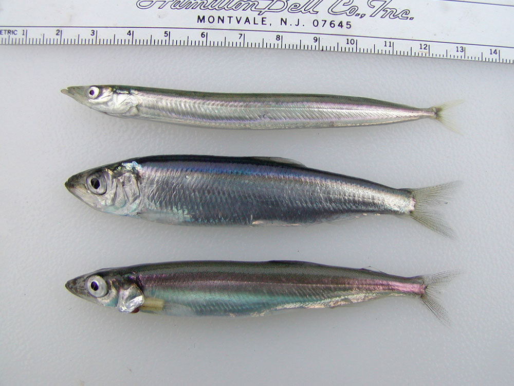
Changes in the abundance of forage fish (small, schooling fish that are the prey species of larger fish, marine birds, and marine mammals) can have dramatic effects in marine ecosystems because much of the energy transferred from lower to upper food web levels passes through these species. Forage fish typically produce a large number of offspring and have short lifespans, meaning their abundance and distribution can fluctuate dramatically in response to environmental variation. The response of animals that prey on forage fish to fluctuations in forage fish abundance depends on the predator’s ability to shift its foraging behaviors and the relative nutritional value of each species of forage fish and other types of prey in their diet.

Black-legged Kittiwakes foraging on Pacific sand lance. Photo by Sarah Schoen, USGS.
Where are we sampling?
Our study includes surveys throughout Prince William Sound and a seasonal monitoring station on Middleton Island in northern Gulf of Alaska. More information about ongoing seabird monitoring and research is available at: https://middletonisland.org/.
How are we sampling?
The primary objectives of the forage fish monitoring project are to: 1) monitor the status and trends of forage fish in areas with known persistent aggregations of predators and prey during fall, and 2) support annual field and laboratory efforts to continue the Middleton Island long-term seabird diet index in spring/summer, 3) assess changes in forage fish abundance indices on acoustic-trawl surveys during summer, and 4) support Herring Research and Monitoring program aerial survey validation efforts in summer.
To meet our first objective, we integrate directly with the humpback whale and marine bird predation studies to provide estimates of forage biomass in the immediate vicinity of predator aggregations. To meet our second objective, in a collaboration with the Institute for Seabird Research and Conservation, we use seabirds as samplers of forage fish at Middleton Island to continue the long-term seabird diet data collection program as a cost-effective means to monitor forage fish stocks in the northern Gulf of Alaska. To meet our third objective, we conduct multi-frequency hydroacoustic transects and trawls to identify species composition and size distributions of ensonified targets. To meet our fourth objective, we sample fish schools from a vessel on the water under the direction of the aerial survey team to validate their observations.
What are we finding?
Long-term monitoring of forage fish in the northern Gulf of Alaska indicates continued changes in species composition and availability, with important differences among key species. Seabird diet data from Middleton Island show that capelin have increased in recent years, suggesting continued recovery following declines during the 2014–2016 marine heatwave.

Interannual variation in diet composition of black-legged kittiwakes during spring (top) and summer (bottom) on Middleton Island.
In contrast, Pacific sand lance have declined over the longer term, with only a brief increase following the heatwave and lower levels observed again in 2024 and 2025. These patterns are consistent across multiple indicators, including seabird diets and nearshore surveys.
Other forage species show more variable patterns. Pacific herring increased in seabird diets in 2025, while juvenile salmon decreased relative to the previous year. Alternate prey species, including greenlings and other demersal fishes, continue to contribute to seabird diets and reflect broader changes in forage communities.

Interannual variation in rhinoceros auklet chick diets by species (color) at Middleton Island.
Aerial surveys in Prince William Sound indicate that forage fish school densities increased in 2025 compared to 2024 and were dominated by juvenile herring. Spatial patterns remain consistent over time, with herring concentrated in eastern Prince William Sound and sand lance restricted to core areas where densities have declined since 2010.

Forage fish school density (median surface area per shoreline km surveyed, m2km-1) observed June aerial surveys during 2010 to 2025. Species and age (for herring) classifications are shown in color.
Together, these observations suggest a shift in forage fish communities, with increasing importance of capelin and herring and continued low abundance of sand lance. These changes have implications for energy flow through the pelagic ecosystem and may influence the availability of prey for higher trophic level predators.